D'Estrees Bay Self Guided Drive
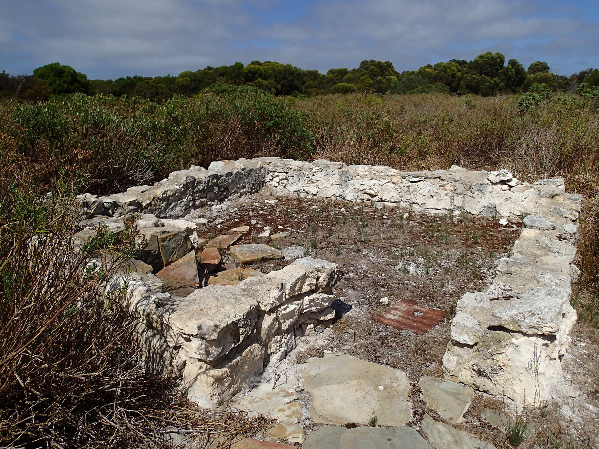
Stop 2 - Wrights Ruin
John Bates is recorded as the first D’Estrees Bay agriculturalist (1872-1874). It is said that he and his family were rendered homeless after a disagreement with a drunken sailor who burnt down their Hog Bay (Penneshaw) home. They walked to D’Estress Bay and set up home in an abandoned whalers cave.
Bates built up the front of the cave and put a chimney in it. In summer water had to be carried two miles. Bates sometimes walked to Kingscote. about 28 miles and returned next day, carrying a 50 pound bag of flour and other stores.
John and Emma Wright lived in what is now Wrights Ruin around 1876 with their five children (Jack, George, Herbert Annie and Laurence). They farmed the D’Estrees Bay area planting malting barley and wheat and hunting wallaby, kangaroo and possum for their skins and meat. Emma planted the jonquils in her garden that can be seen in the area today. The soil was poor and farming was not very successful.
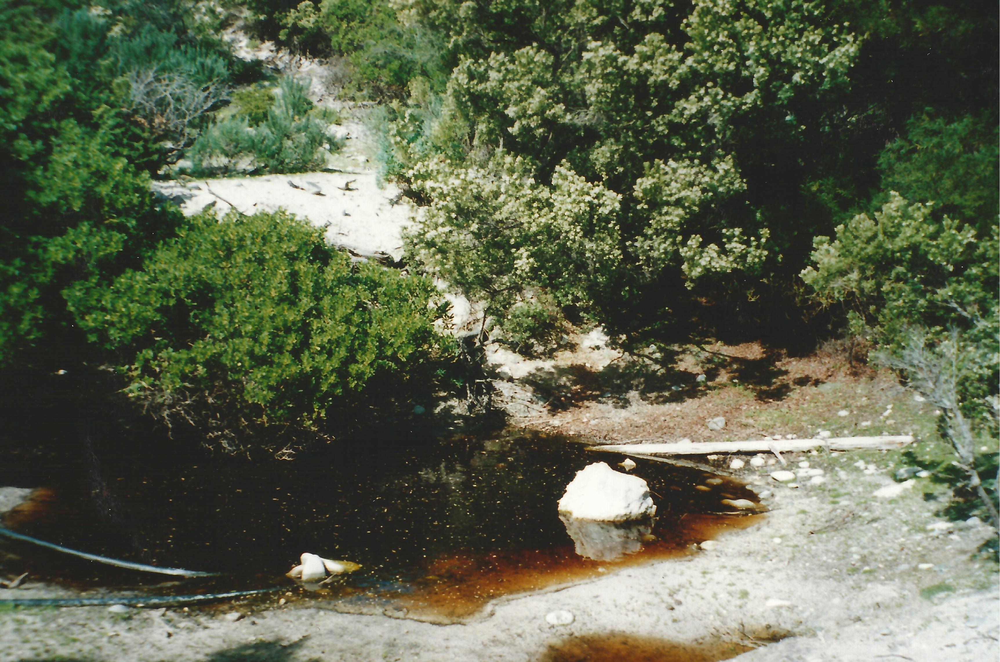
The Lade family had a 99 year lease on a coastal strip of the land from the Second Boat Ramp to Wheaton’s Beach. The Lades would use this land when their MacGillivray farm did not have enough feed for their sheep in drier seasons. The family would walk the flock of sheep, along the limestone rocky road to this strip of land that had grazing land along the coastal verge and around the grain threshing floor at Stop 6. Often the sheep would walk their way back to the MacGillivray farm if they had enough. The sheep survived there because of a natural spring just behind the dunes off Wheatons Beach, just below an old cliff face. The seepage was boarded up and the sheep use to go and drink from it. The sheep needed cobalt blocks to stop them going coasty. The area would have a seasonal burn off for fire protection. It was not uncommon light a match during winter time to create a fire break. As D’Estrees Bay became more popular this practice stopped for safety reasons and practice of using this as farm land became problematic for these two reasons.
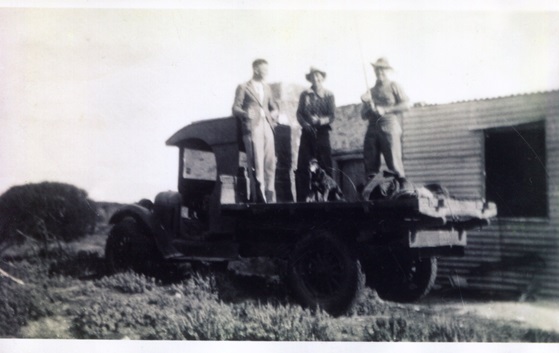
Jack Lade, Aubrey Rowsell and Tony Lade all from McGillivray at Wrights Ruin in the 1950’s
When the Lade family went fishing in the 1950s, they used to stop at this building and have their morning tea inside the stone building which was intact with a roof, and had an old tank on the southern side. There were the remnants of naturalized daffodils and jonquils that coloured the beach side of the building. Worms were gathered from this location on the mullet fishing expeditions.
Friends of Cape Gantheaume Activities
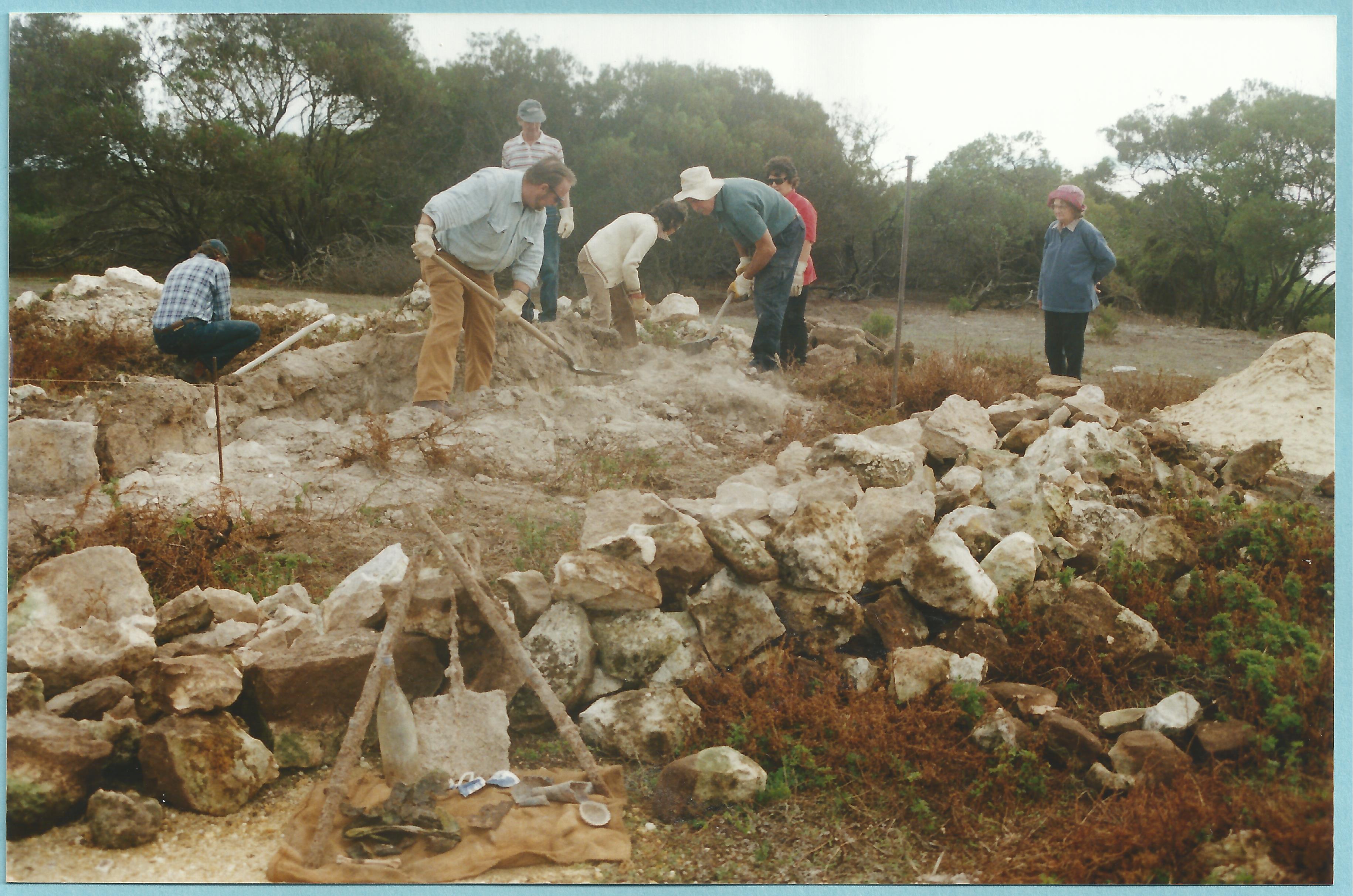
In 2001 the Friends of Cape Gantheaume received funding to stabilize the Wrights Ruin identifying the building wall locations. Since this time the group continues to maintain the internal area of the ruin free of weeds and encroaching vegetation along with maintaining access to the site along the short walking trail.
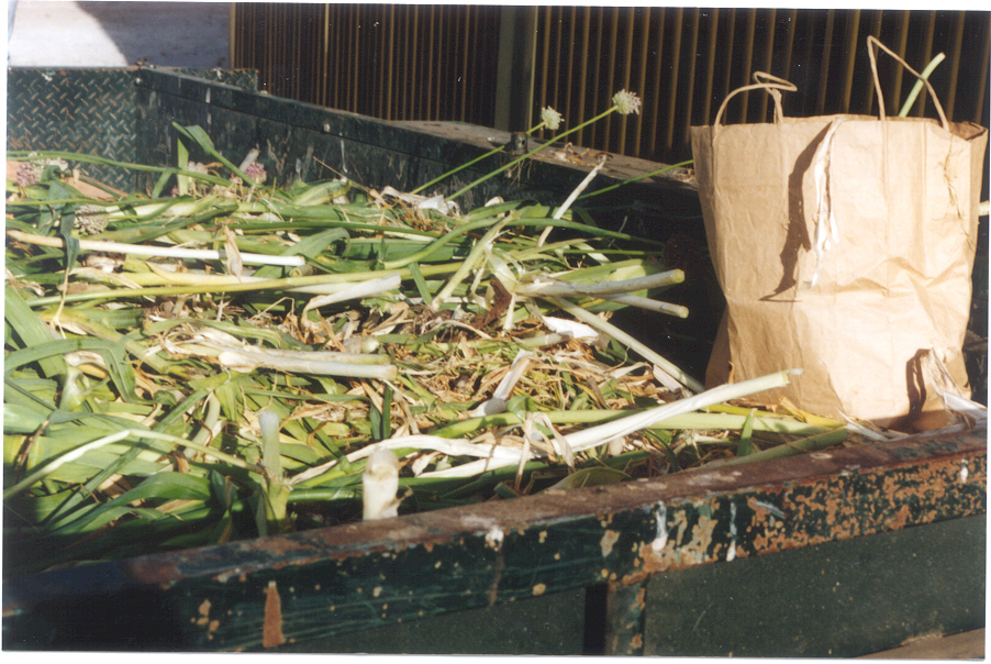
In 2001 the Friends of Cape Gantheaume had a major exercise to control wild garlic in the area. This resulted in a very large trailer being collected and now there are very few plants remaining in the area.
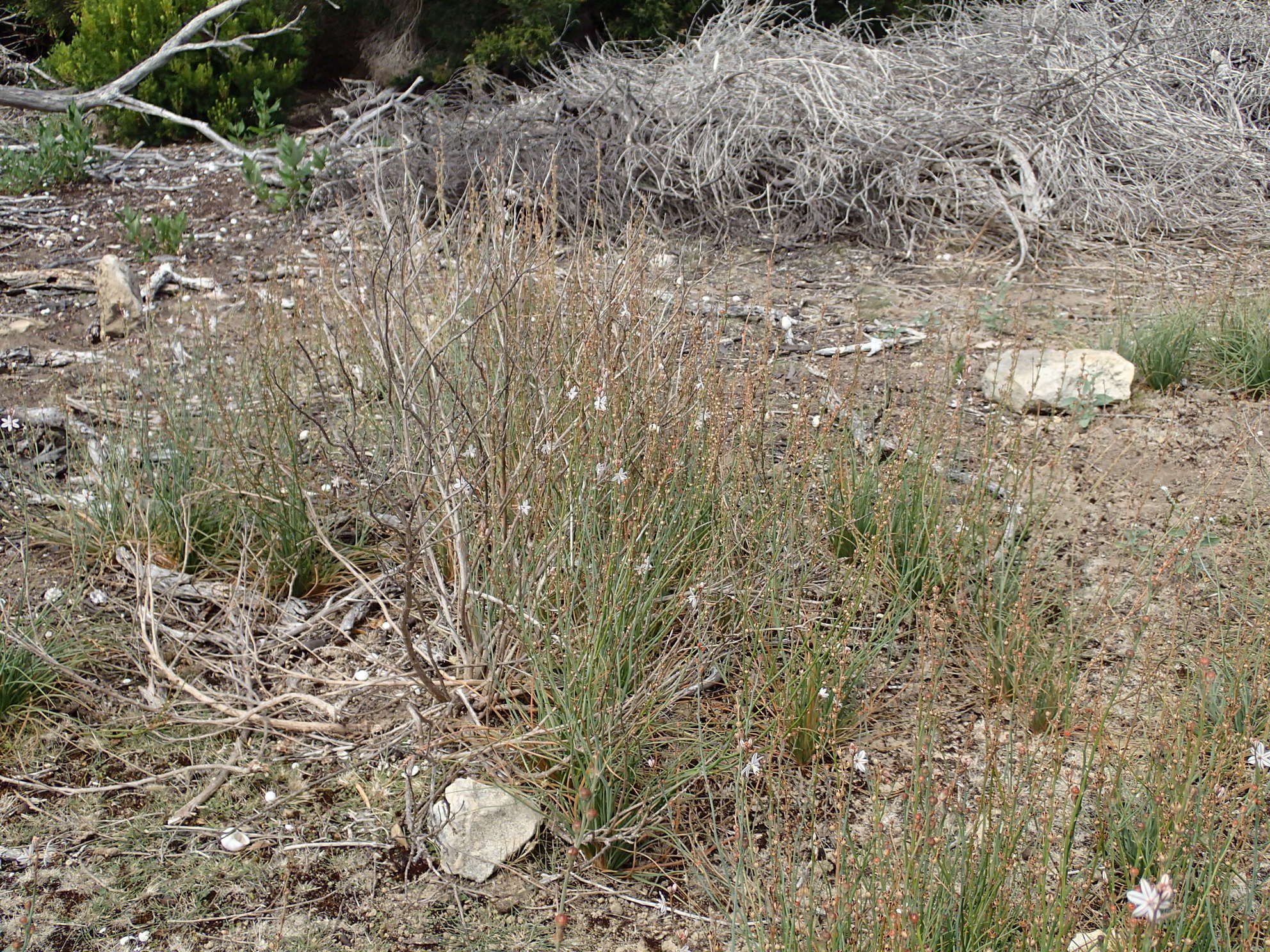
On an ongoing basis the Friends of Cape Gantheaume attempt to control the onion weed in the area by manually pulling the weed.
In 1998 the Friends of Cape Gantheaume visited the spring referred to above.